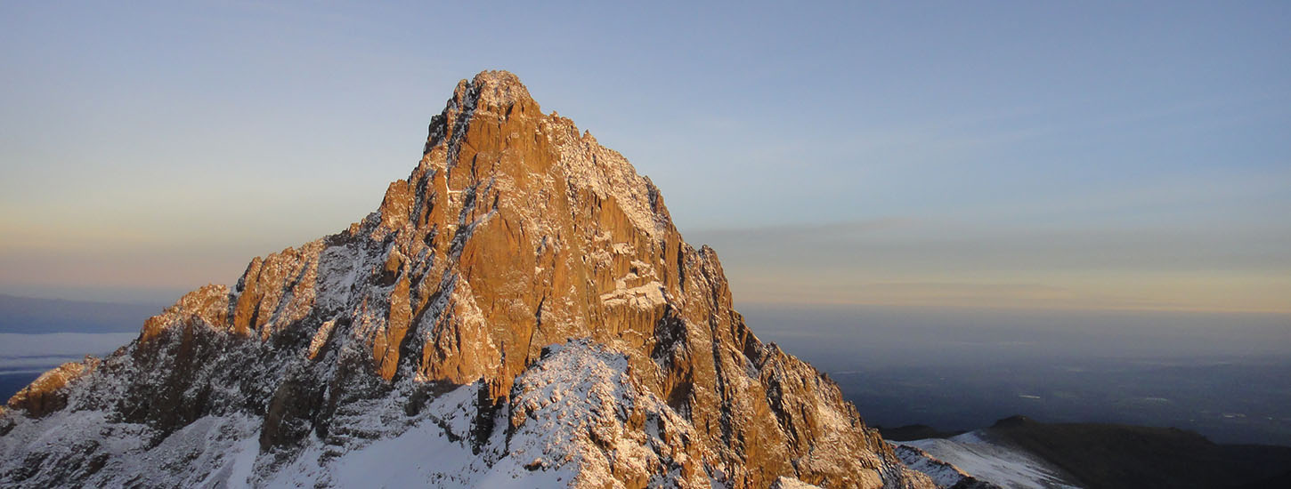
Mt. Kenya National Park is located to the east of the Great Rift Valley, about 175km North-East of Nairobi. The ecosystem lies in Central and Eastern provinces of Kenya. At 5,199m the mountain is the second highest peak in Africa. Mt. Kenya is an important water tower in the country. It provides water for about 50% of the country’s population and produces 70% of Kenya’s hydroelectric power.
Regardless of the route, no special equipment or previous experience is required to climb the Mount Kenya.
We organize treks to the summit of the Mountain using 4 different routes: The Sirimon-Chogoria, The Sirimon–Naro Moru, The Burguret–Chogoria and the Timau Route. Regardless of the route, no special equipment (just walking gear) or previous experience is required to climb the Mount Kenya. A good level of fitness but specially an exceptional level of determination (the last 500 meters of ascent to the summit will be extremely demanding, regardless of your physical condition) is all you will need.
The Naro Moru traverse is the most popular route for trekkers on Mount Kenya . It owes its popularity to the steady rate of ascent (up Sirimon) and the quick descent that is possible down Naro Moru route. Whilst it doesn’t cover all the features of this beautiful mountain the route itself is very scenic passing up the sweeping Mackinder’s Valley towards Shipton’s Camp and then descending through the notorious vertical bog and dense rainforest on the Naro Moru route. The route is just under 60km in total and involves an ascent (and descent) of 2,400m.
The Chogoria traverse is arguably the definitive Mount Kenya trek. Mount Kenya reaches an altitude of 5,199m, but the trekker’s peak at Point Lenana is at 4,985m. This traverse enters at the Sirimon Gate ascends up towards Point Lenana and then down the Chogoria route to the Chogoria Gate. The Sirimon-Chogoria traverse usually takes 5 or 6 days in total. The ascent is up the scenic and relatively easy Sirimon route – the most popular route up the mountain. The descent goes down Chogoria which is unarguably the most striking on the mountain, featuring incredible sheer sided gullies, tarns and waterfalls. The route is 60km in length and includes an ascent (and descent) of 2,400m.
The Sirimon traverse is a more gradual trek to the summit, traversing areas of rich forest cover before emerging into the sprawling moorlands. This hike is usually rated as the easiest among the short trips and is quite popular with persons attempting to reach an altitude exceeding 4000m for the first time. It is a good choice for large trekking groups as it follows the same trail up and down, making it convenient for those who are unable to reach the summit to stay behind at lower camps to wait for the rest of the group to complete the trip then descend together. Unless preferred, camping is not necessary as accommodation is available in a lodge and mountain huts throughout the trip.
We do not usually recommend the Timau route because is little used nowadays, and there are few facilities, little marked paths and sparse tree cover on this side of the mountain, so the ascent is mostly through wide open country.
Mount Kenya has several small glaciers (although fast disappearing), so it's cold year round. At night at the higher elevations the temperature can drop as low as 14 Fahrenheit (-10 Celsius). Typically the early mornings on the mountain are sunny and dry, and clouds often form by noon. It is possible to hike Mount Kenya throughout the year but it gets more difficult during the rainy seasons from mid-March to mid-June and October to mid-December.
For every detail and doubt about these itineraries or for building a custom private one, please contact us through our contact page.
In the following section, you have the details of every route. We make a big effort to offer the best possible prices, which depend upon many factors like the time of the year, the number of tourists, the constantly changing prices of gas and park fees, etc.

